#1: Crime & Cartography
Lots and lots of maps.

The Update
Happy New Year! My holidays have been expectedly consumed with eggnog and getting this Substack off the ground!
I’ve also been reflecting a bit on the year that was 2025. It was a good one! I delivered a few walking tours, wrote a handful of quality articles, got back into making TikTok and Instagram reels, was a podcast guest for the first time ever (thanks again Adam and Grayson of the Muddy York Podcast!), made great friends and acquaintances in the Toronto history universe, was an active member of two great heritage groups in Toronto, and I was nominated for a Heritage Toronto Award!
I’ve also started to look forward to 2026 in thinking about the kinds of projects I want to take on. I’ve got ideas.
The TOHistory Resource
Toronto Historic Maps & Goad’s Atlas of Toronto—Online!
I peruse Toronto Historic Maps almost daily. It’s a good start to determine the date of structures and neighbourhoods. And it is so neat to see the physical development of the city. Charles Goad is just an unsung Torontonian. A civil engineer, a cartographer. A man of great talent. (Fun fact: Mr. Goad lived at 80 St. George Street, and through his fire insurance maps, one can see that the house no longer exists.)
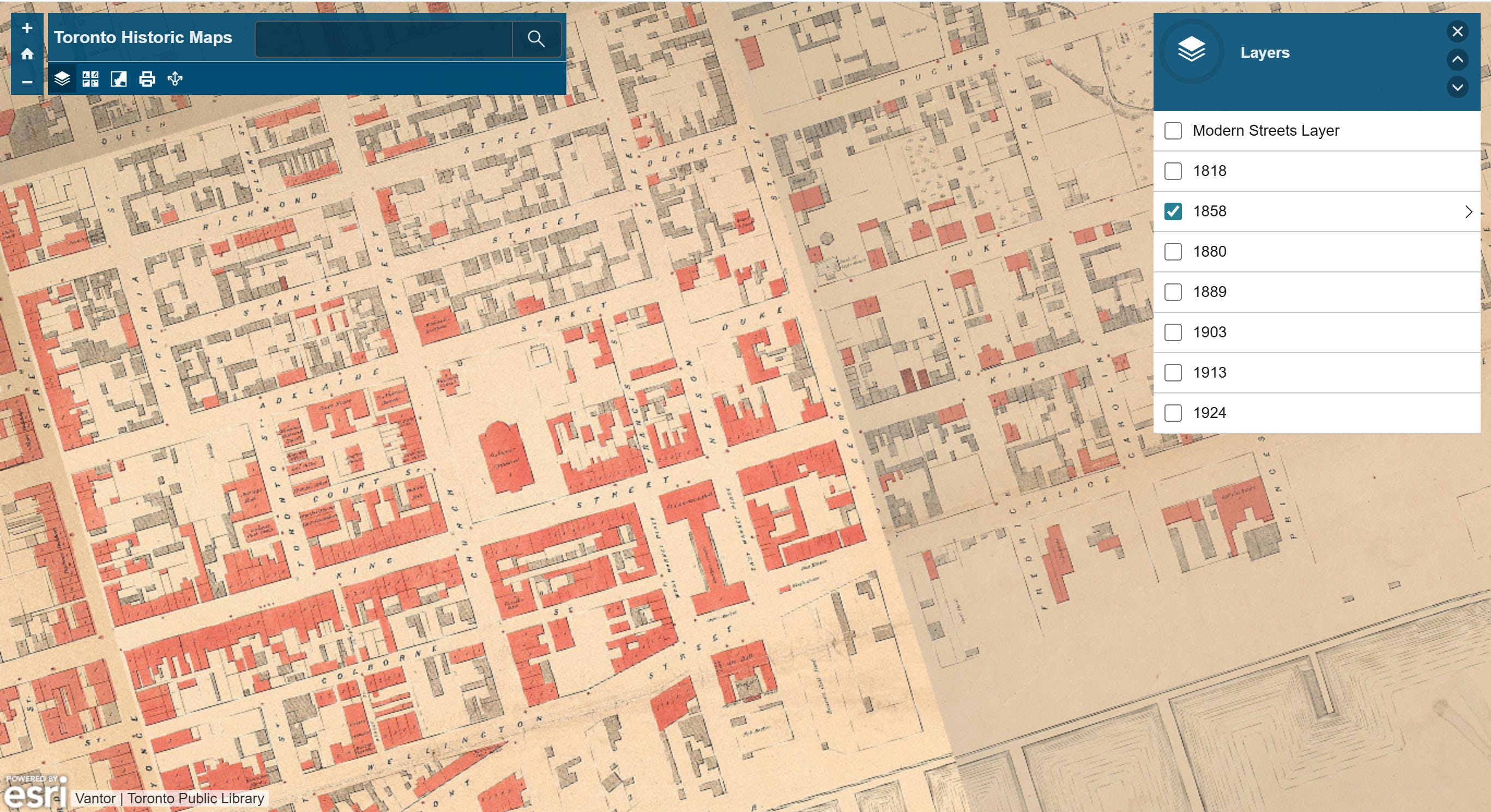
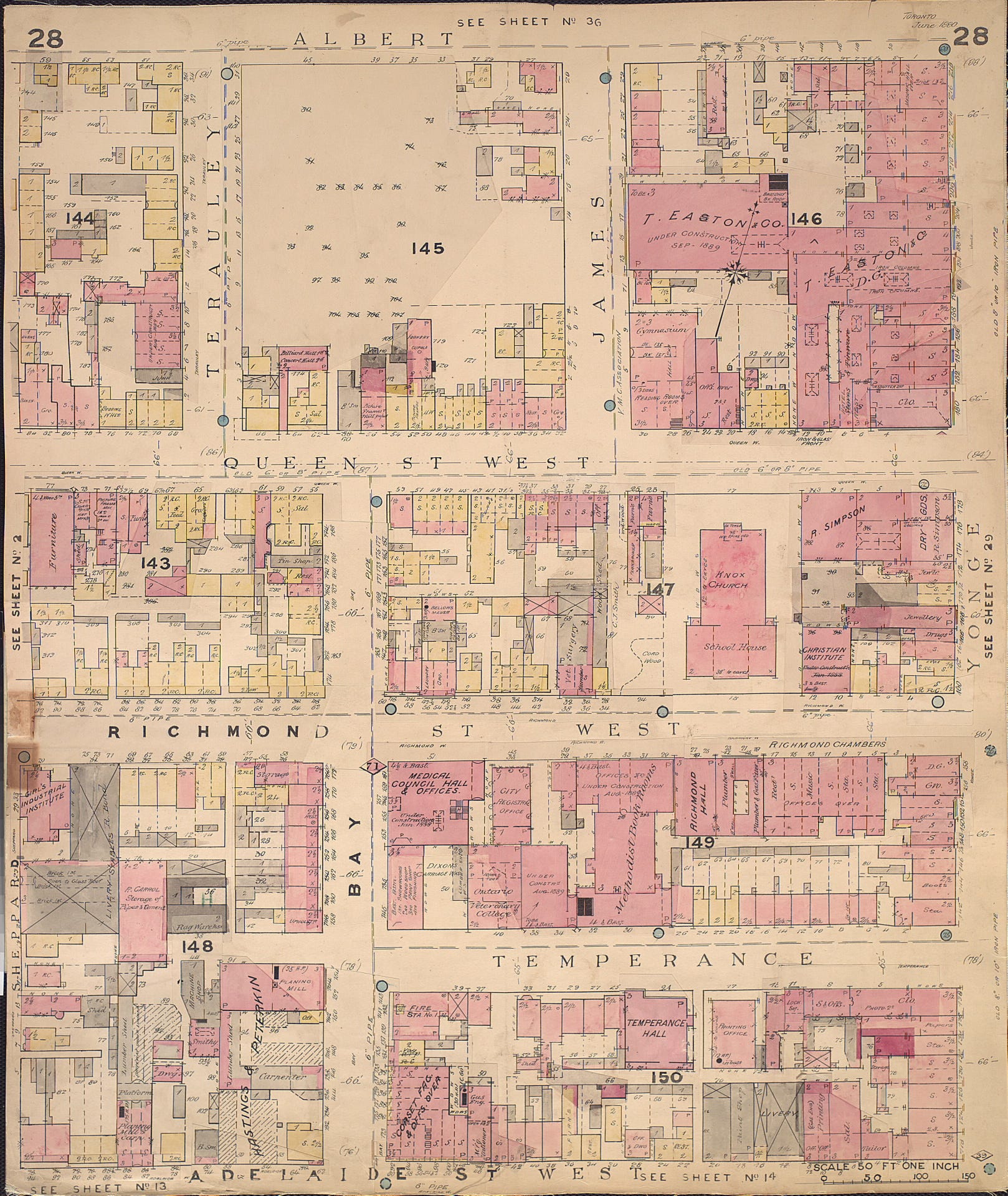
Next, the amazing Nathan Ng compiled basically every Goads Fire Insurance Map of Toronto out there. It’s got maps the Toronto Historic Maps tool doesn’t, like this super-neat, super-detailed 1889 map. It notes things like where stairs are located, layouts of buildings, shapes of roofs and cupolas, and even buildings under construction.
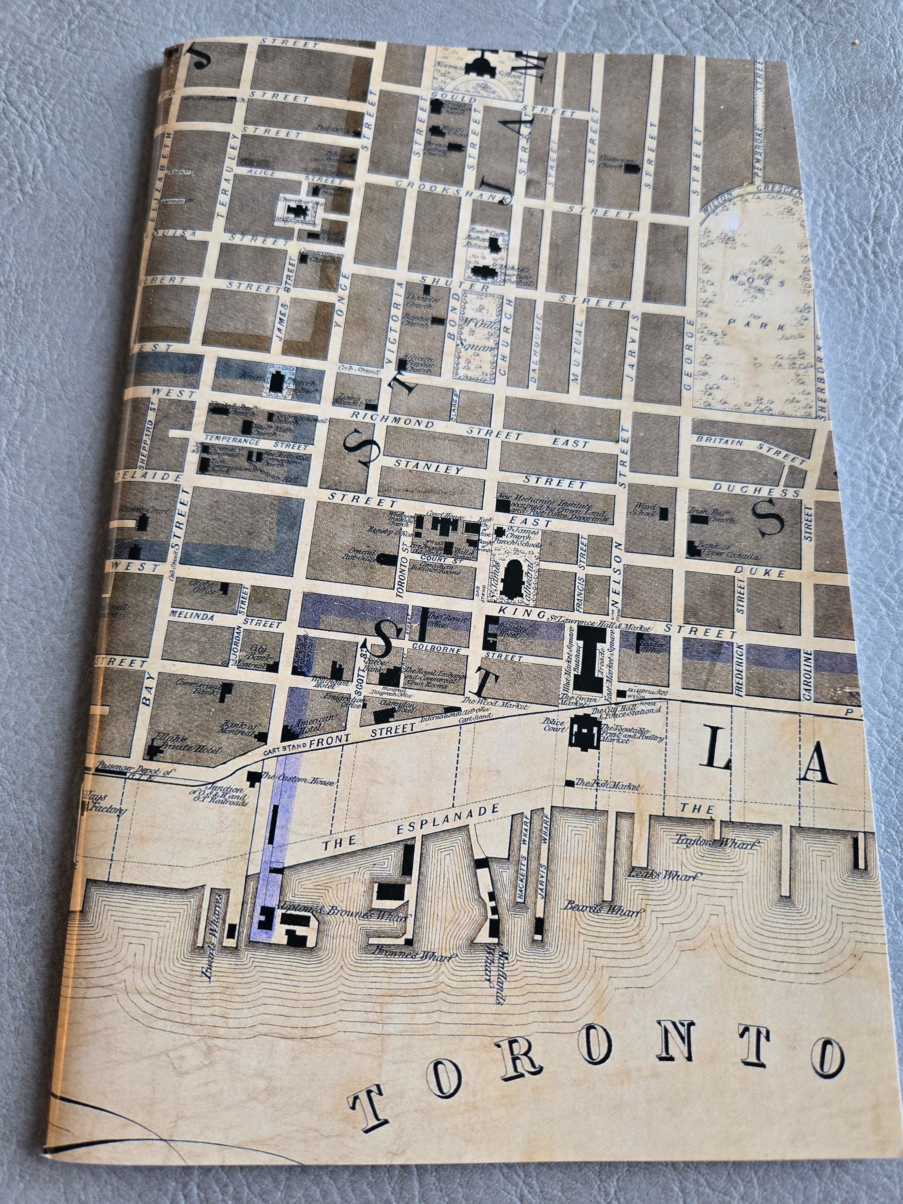
The Old Map
https://oldtorontomaps.blogspot.com/2013/01/1857-fleming-ridout-schreiber-plan-of_7.html
This is a good-looking and incredibly detailed map. Its creators are also pretty cool. Architect, surveyor, railway engineer, and inventor are amongst their collective professions. Sandford Fleming is just a legend on his own.
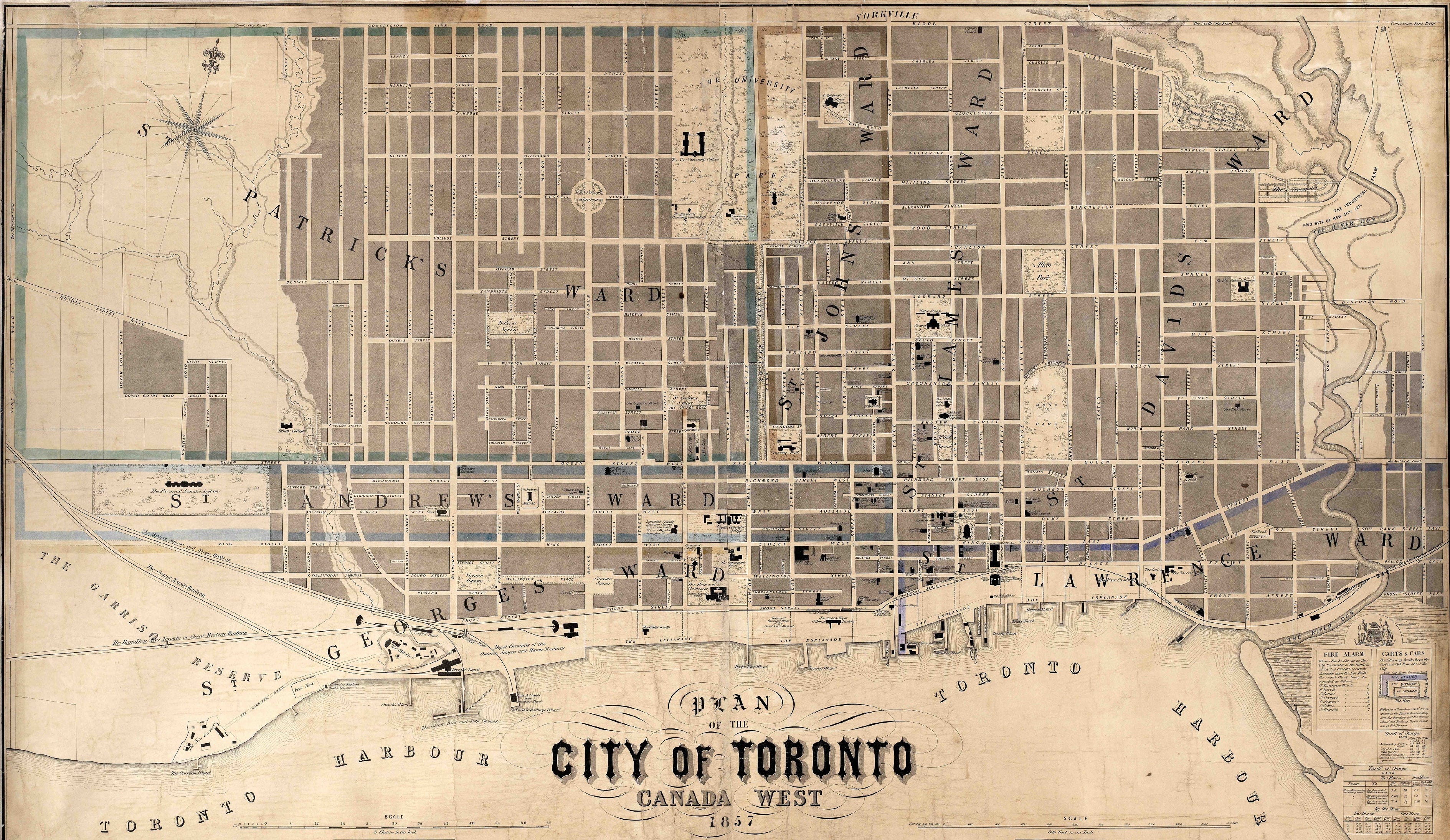
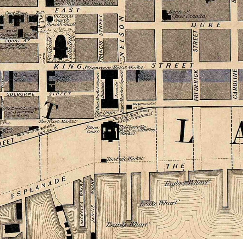
This section around St. Lawrence Market is a good example of its greatness. Toronto’s first City Hall was a multi-purpose structure with a Police Station and Police Courts — and the 1857 Plan tells us where in the building each was located! There’s also the sites of markets, it animates the trees a little bit, and there’s even cab stands!
…Annnnddd it’s the cover design for a notebook I got for Christmas! You can purchase it at the Spacing Store! (This is not an ad but it may be my favourite shop in the city.)
The Old Newspaper Article
The Globe’s “City Police” section is my favourite column in Toronto’s historical newspapers. It includes colourful Police Court records of ‘everyday’ crimes like assault and drunken/disorderly conduct. During the winter months, it included a special transgression: snow removal (or lack of). Topical, isn’t it?
In the February 20, 1858 edition, there were a couple of cases of alleged offenders:
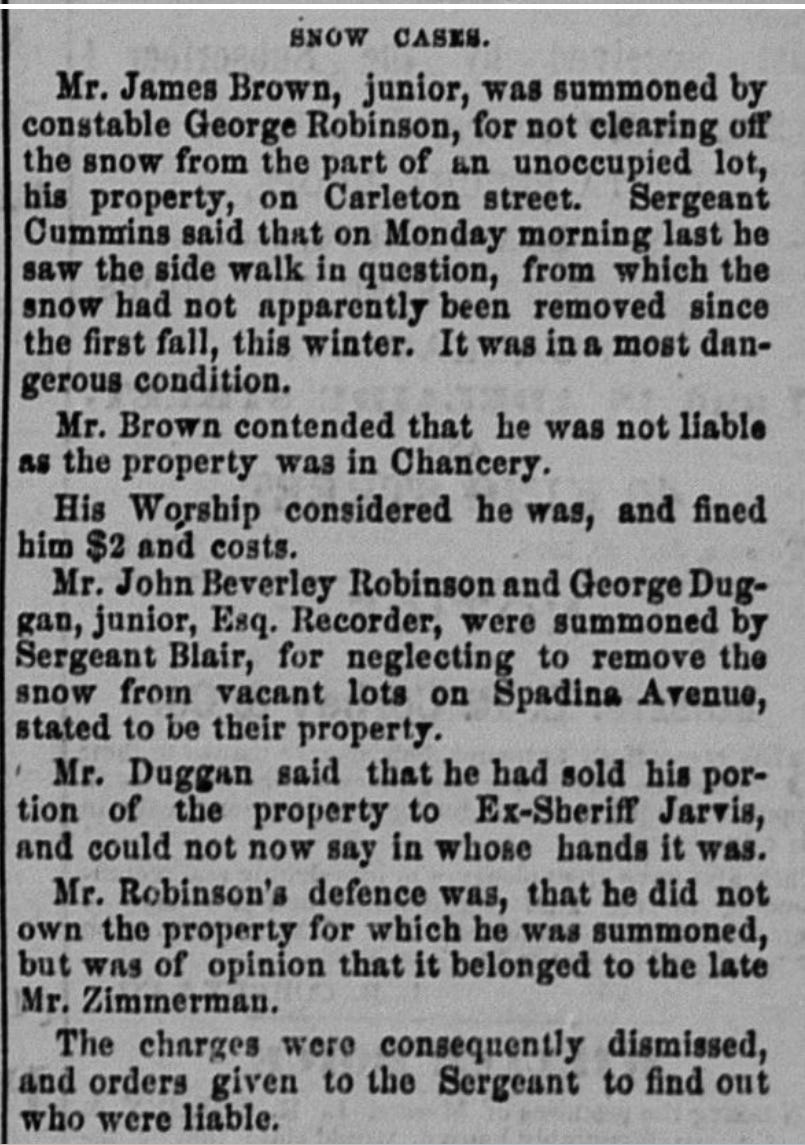
The first was a case on an empty lot on Carl(e)ton Street which had been uncleared for a while apparently. The owner, Mr. Brown, argued he wasn’t responsible. I believe Chancery might have referred to the Court of Chancery, which, if I understand correctly, handled property disputes. Mr. Gurnett, the Police Magistrate, did not agree and fined him.
Surprisingly, the other two offenders were high profile names in Toronto: John Beverley Robinson and George Duggan. Robinson was a lawyer, judge, and politician. Just a prominent 19th century Torontonian. Duggan is a lesser known man in the annals of Toronto history. He presided over the Recorder’s Court in the 1850s, which were a step up from Police Court and a step down from the more serious Assize Courts. Both men argued the neither property were theirs and were ultimately excused.
From My Archive
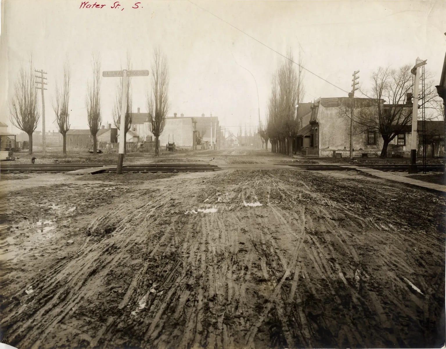
Toronto’s Lost Streets: Tate & Water Streets
Tate and Water Street don’t exist anymore. There were once working-class streets in Toronto’s east end. Go back to the Toronto Historic Maps tool and shift through the Goads maps of the area around Corktown Common. You’ll see a great transformation. Most notably, Tate and Water and their surroundings were swallowed up by railways. Now, their former locales are located in the new-ish West Don Lands neighbourhood.
The Review
The Gaol Carpenter’s Diary by Chris Higgins
Chris Higgins and I became acquainted several years ago through our mutual interest in 19th century Toronto crime and punishment, and the Brooke’s Bush Gang in particular. Chris told me then he was working on a book that brought together stories of old Toronto’s violent underbelly. Fast forward to now and we’ve got The Gaol Carpenter’s Diary!
Full disclosure that Chris did send me a book and acknowledged me in it (thank you again Chris!), but I must also say that I do not intend these reviews to be too critical, so Chris’ graciousness did not affect the words I will write here.
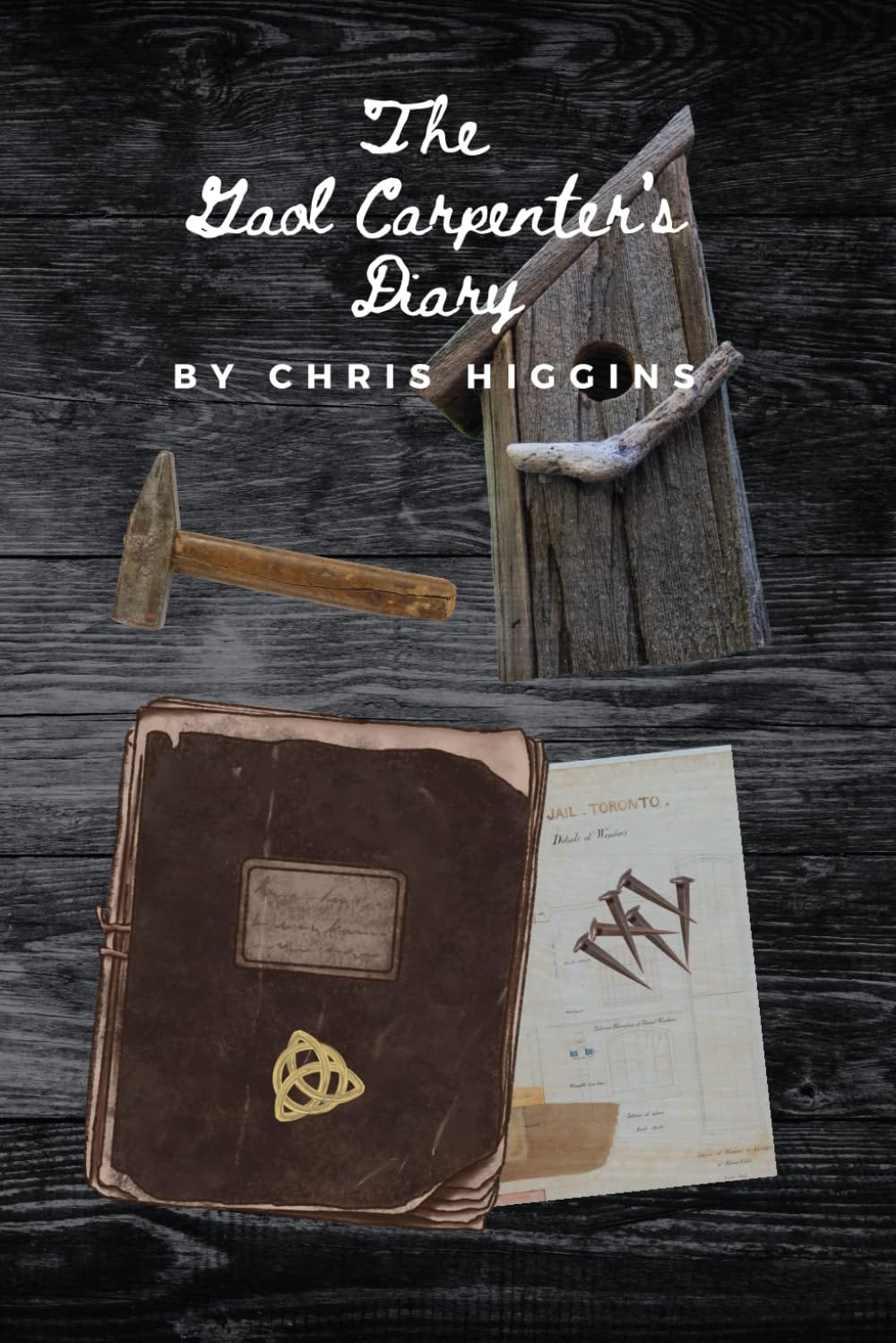
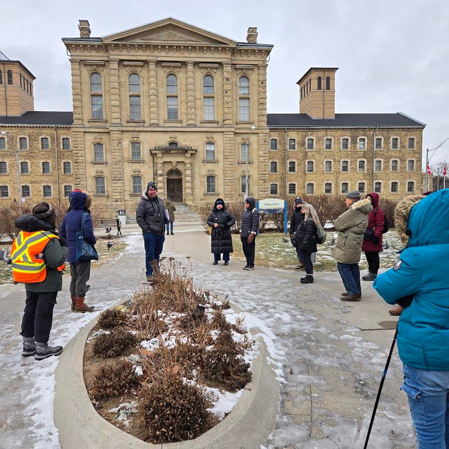
The Gaol Carpenter’s Diary chronicles the life of Michael Callaghan, a fictional worker of Toronto’s jail — the old prison at Front and Berkeley (which can be seen in the 1857 Plan of Toronto above) and its successor, the infamous Don Jail (pictured at the top of this post) — and his intersection with some of Toronto’s most notorious crimes. It might be the first fictionalization of Mr. George Allen, the jail governor, which tickles me as a historian.
As someone who has spent many hours combing through news accounts in The Globe from the 1800s, it was very neat to see these events thrown into a work of imagination. Chris has resourcefully included real information from the newspaper — like when Mr. Allen mentions that the old gaol was built for 80 souls but had 150 ‘residents’ in 1849, this is a real fact in a report of the jail in the Globe in that year!
The Gaol Carpenter’s Diary is a work of historical fiction but it has great basis in reality. And it belongs on any bookshelf of Toronto history and related works!
See you in two weeks!
Love this deep dive into Toronto's cartographic treasures. The way Goad's fire insurance maps capture granular details like stair locations and building materials really transforms them from navigation tools into time capsules of urban life. Been thinking about how layering these historic maps with pedestrian flow data could reveal forgotten social networks in workin-class neighborhoods like Tate & Water. The spatial density of those maps basically encoded whole communities that got erased by railway expansion.