#10: Lost & Found
Loss and discovery, old and new....and the census!

The Update
Hello! It’s been a week for me. I have been under the weather and it’s probably due in part to my weekend. Although, I can’t be too upset because I had a great Jane’s Walk!
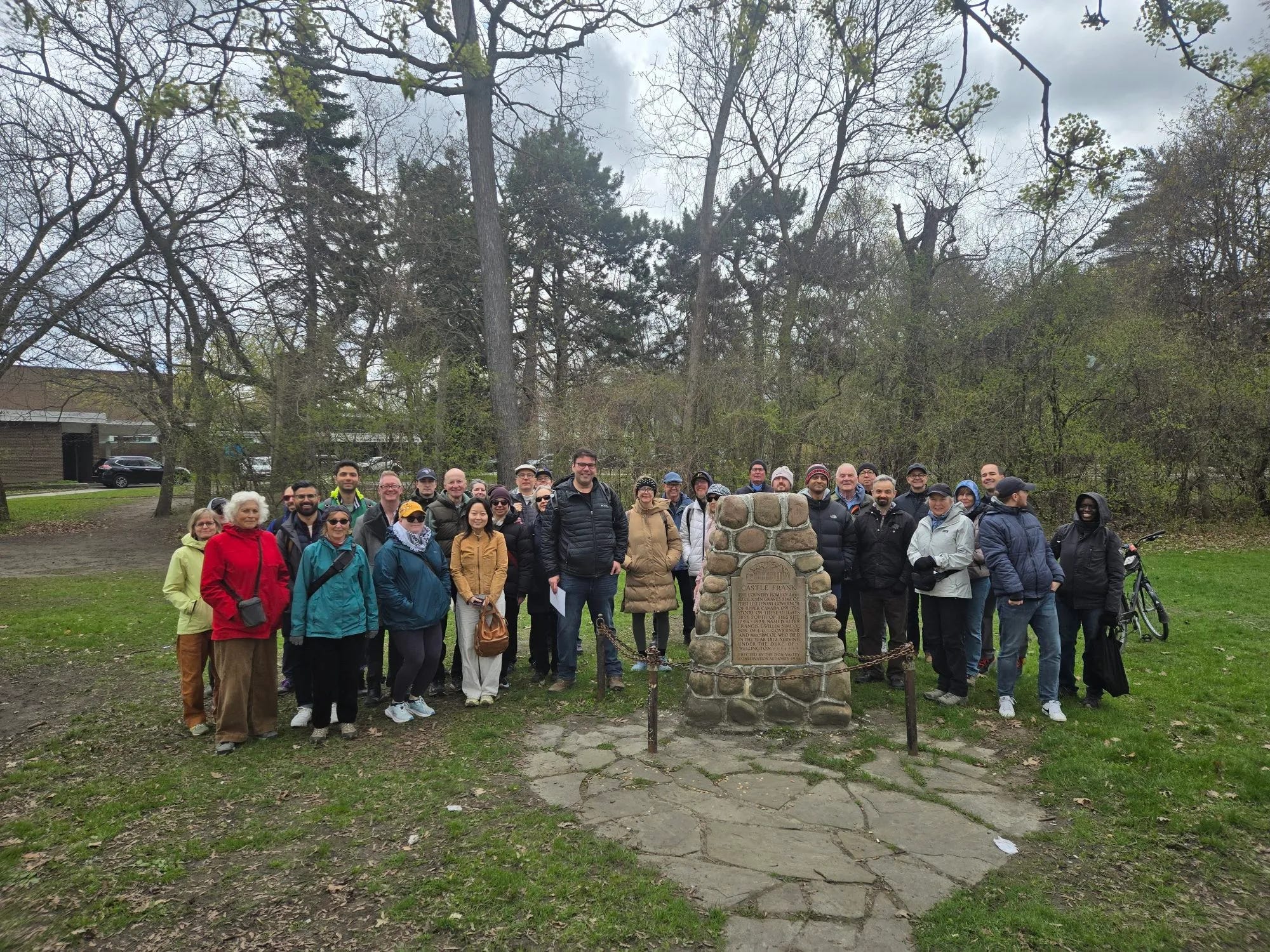
As I told you about last time, on Saturday, I hosted my “Finding Old Castle Frank” walk! It was a lot of fun! There was a very gratifying turnout of about 50 people! It was a few years in the making and I’m glad I finally pulled it off! I was pleased that the ravine hills weren’t too muddy. Apologies to everyone who wanted to find the actual site of Castle Frank. Maybe in a future version.
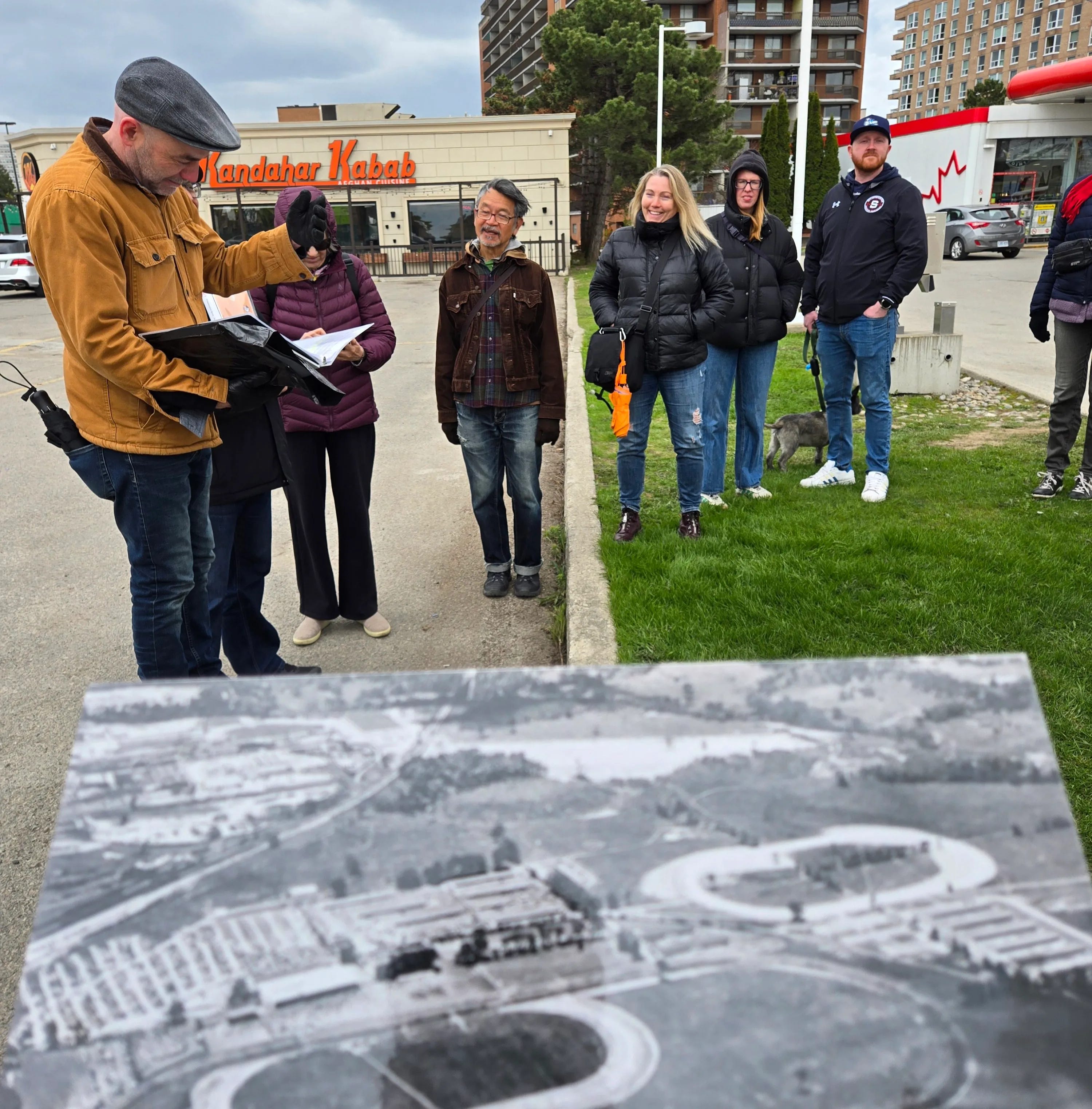
Afterwards, I took the 25 Don Mills bus and attended a walk “Rediscovering Thorncliffe Racetrack” by Edward Brown and Barry Pieterson. Did you know there was 1-mile racetrack in Thorncliffe Park? We followed it’s former course around Overlea Boulevard to the Millwood Bridge through to the interior neighbourhood and even inside East York Towne Centre. There were stories told about the neighbourhood and it was really neat to be a part of. Thorncliffe Park was mixing pot of different peoples, much like today!
The TOHistory Resource
See it: The Census
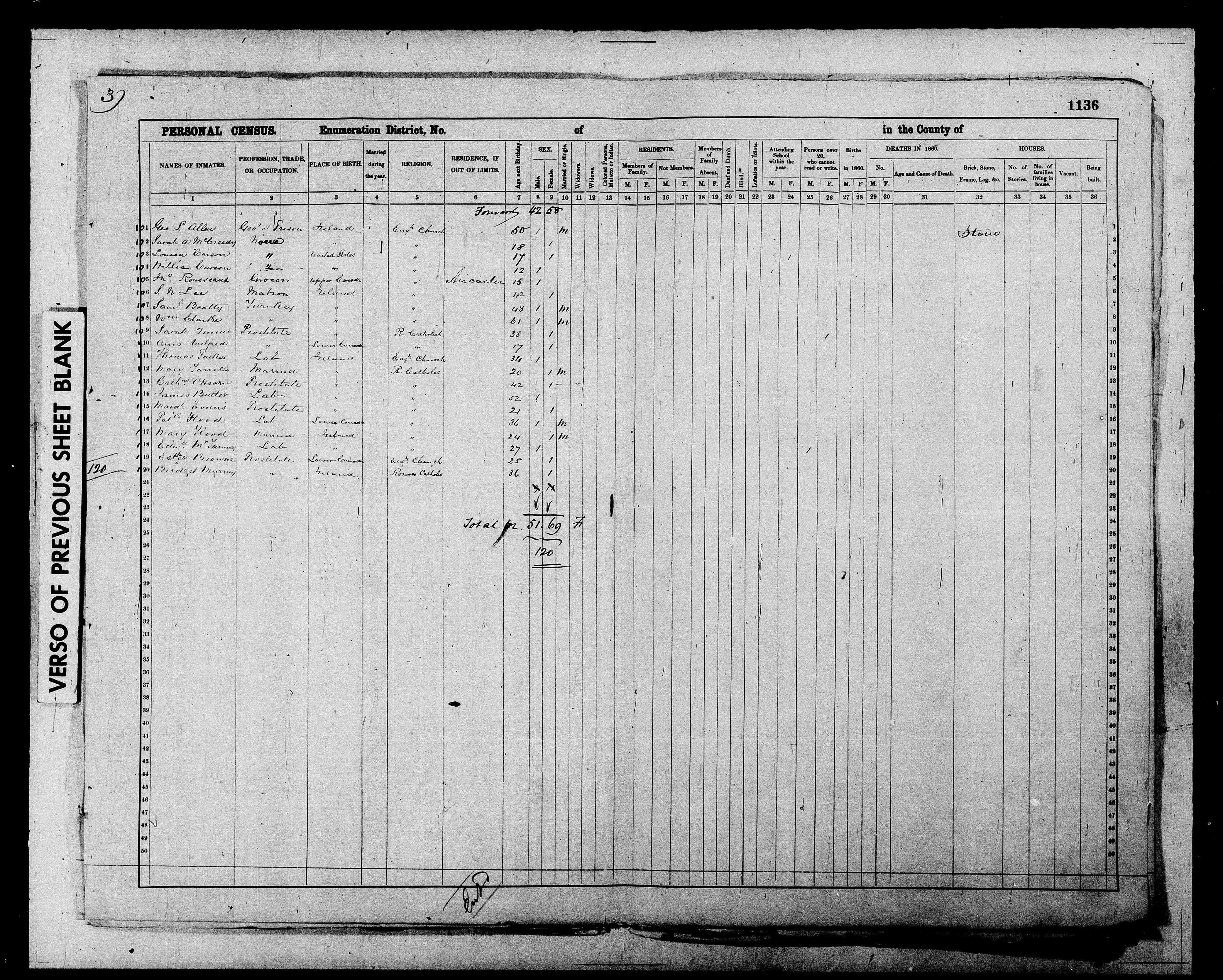
Census forms are out, so I thought it’d be a good time to plug Library & Archives Canada’s Digitized Censuses. I’ve recently discovered this as a historical resource to aid in filling out the (hi)stories of research subjects and it’s been great! It can be finnicky as spellings can be inconsistent, even between censuses, but finding someone is such a victory!
During my ongoing project about mid-19th century Toronto crime, I found out that the Toronto Jail had its own ‘district’! According to the 1861 census, there were a lot of…prostitutes in jail. But even the governor of the jail, George L. Allen, is noted. He is also in the first edition of Toronto History Curiosities. There were a total of 120 people accounted for in the jail.
The Old Map
Look: Algate’s Toronto & suburbs, 1935
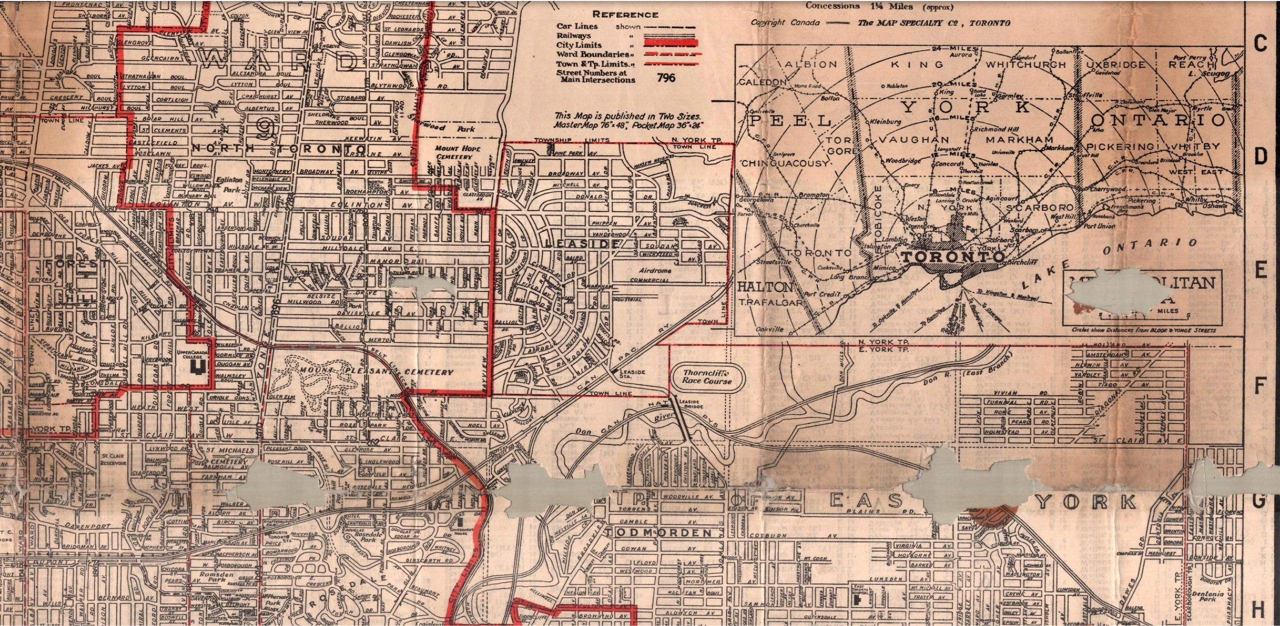
Until you get to the 1950s and the creation of Metropolitan Toronto, there aren’t too many maps that show Toronto and the surrounding independent communities. “Algate’s Toronto & suburbs” has quite a bit of it. Granted, it only extends north to Wilson Avenue/York Mills Road (curiously noted as Twentienth Avenue), but there is a good chunk of Etobicoke and an inset for the south part of Scarborough!
I like the detail in this map. The Thorncliffe Racetrack is noted, right beside the Leaside Viaduct, and the nearby Air Drome in Leaside!
The Old Article
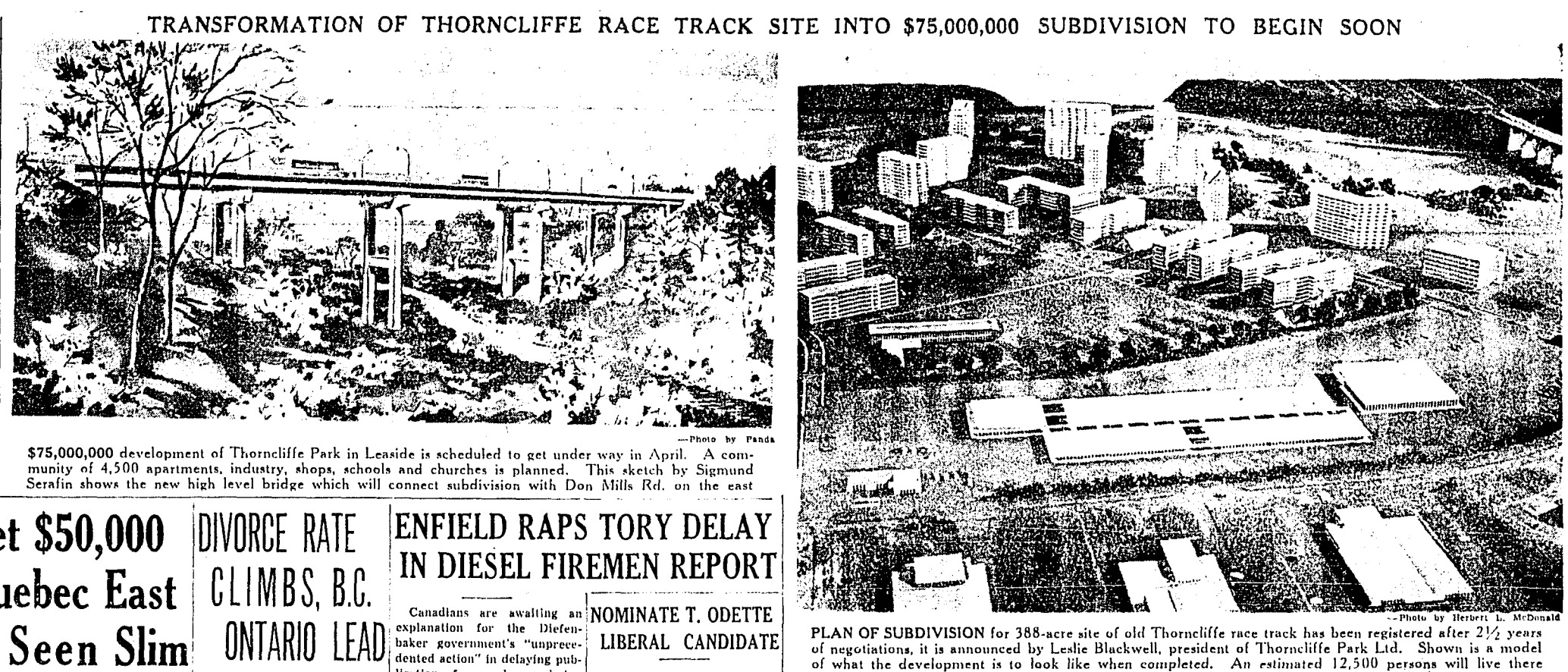
Read it: “Transformation of Thorncliffe Race Track Site Into $75,000,000 Subdivision To Begin Soon,” Toronto Daily Star, February 25, 1958
The geographic transformation from a racetrack to a neighbourhood in a central-ish part of Toronto was massive. The plan was to create “an integrated community of 4,500 apartments, industry, shops, school, and churches.” And while the industry is mostly gone, I’d say the neighbourhood remains with that vision today. I also looked into Leslie Blackwell, the president of Thorncliffe Park Ltd: Unfortunately he did not live much longer after the announcement of this plan, so he never saw the final redevelopment.
From My Archive
Read it: Scenes From O’Sullivan’s Corners & Muirhead’s Corners
At risk of sounding odd, I was impressed with myself reading this piece again. I went in with an idea, a question “When does a place stop being a place?” and stuck with that theme. It’s what struck me most as I was researching about O’Sullivan’s Corners.
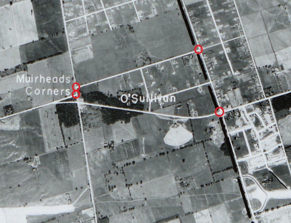
The area had a school and post office in the 1800s, but things really took off with a hotel that was a hotspot for Sunday drives and lunches during the early age of the automobile. Then there was a drive-in theatre and a redesign of the road network. A A highway was added and landmarks started to disappear — like the school, the hotel, and finally the theatre. While the name ‘Sullivan’ exists, the continuity from O’Sullivan’s Corners seems faint.
The Review
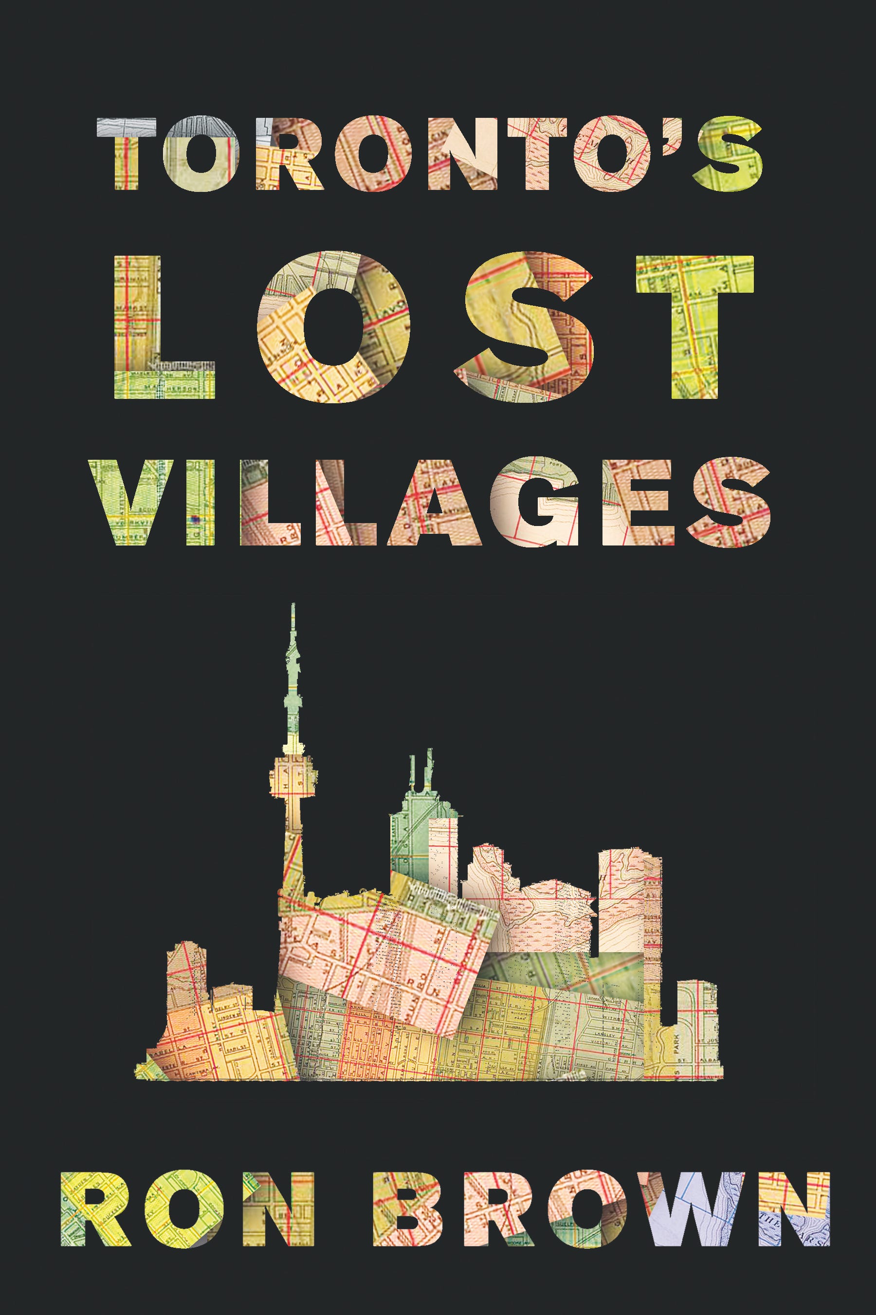
Read it: Toronto’s Lost Villages by Ron Brown
Toronto’s Lost Villages is such a thorough tour of Toronto’s ghost neighbourhoods. It can be so puzzling how prominent names just fell out of common use. I think of Todmorden, noted in the Algate map above. It is now absorbed into East York. And then there’s O’Sullivan’s Corners, noted above, and L’Amoreaux — both exist in name in a small sense but I doubt hardly as neighbourhood identities. Toronto’s Lost Villages is another well-told chapter in the grand idea that Toronto has always been changing and is good preservation of the formerly lost.
See you in two weeks and Happy Mother’s Day!